My Experience at the 2025 SPLIT Remote Sensing Workshop
I (Angela Nyangate John) attended the 10th SPLIT Remote Sensing Professional Workshop, held from June 30 to July 5, 2025, in Split, Croatia. This hands-on event brought together graduate students, researchers, and professionals to explore the latest advancements in remote sensing technologies.
The workshop featured lectures and tutorials on LiDAR, synthetic aperture radar (SAR), artificial intelligence, hyperspectral imaging, predictive modeling using drone and satellite data, and object-based image analysis. Speakers came from a wide range of institutions, including the ESA, Idaho State University, the University of Valencia, Eurac Research, the University of Split, the Croatian Forest Research Institute, Oikon Ltd., and others. It was an intensive and rewarding week of knowledge-sharing set against the stunning backdrop of the Split coastline.
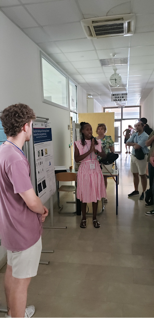
Poster Session: Mapping Global Reforestation
A personal highlight was the poster session on July 1st, where I presented our work titled “Mapping Truth: Validating and Detecting Global Reforestation Efforts Using Satellite Data.”

Our project leverages Sentinel-2 imagery and geospatial data to validate self-reported reforestation activities and create a consolidated global dataset. I also showcased our ongoing efforts to detect reforestation from space.
The presentation sparked engaging discussions on remote sensing’s role in forest mapping. I received constructive feedback from forestry and geospatial experts, which will help refine our methodology. Conversations also highlighted the importance of geographic and ecological factors like species diversity, climate, and latitude in reforestation monitoring.
Key Sessions and Technologies
The workshop included a variety of hands-on and theoretical sessions. Notable ones included:
- Wildfire Risk Modeling Dr. Ljiljana Šerić (University of Split) presented a session on machine learning for wildfire and spatial risk management. A key highlight was the use of stacking classifiers for land cover classification using Sentinel-2 data—outperforming individual ML models. We also explored Lazy Classifier methods to automate model selection.
- UAV Hyperspectral Sensing Prof. Donna Delparte (Idaho State University) gave a compelling lecture on UAV-mounted hyperspectral sensors and their use in environmental monitoring. The session also walked us through data processing and visualization using ArcGIS.
- ARTMO Hyperspectral Toolbox Dr. Jochem Verrelst (University of Valencia) introduced the ARTMO Toolbox for vegetation mapping using hyperspectral data. He demonstrated how ARTMO enables leaf feature extraction and retrieval of biophysical properties.
- Drone LiDAR and LAStools In a hands-on workshop, we learned to plan UAV LiDAR flights, process point clouds, and identify terrain changes using LAStools. We also used Agisoft Metashape to preprocess field-collected data from Krka National Park and build digital elevation models and orthomosaics.
- ESA SAR Missions Dr. Thibault Taillade (ESA) presented a keynote on the latest ESA radar satellites. The upcoming “Biomass” mission, with a 70 cm radar wavelength, was a key highlight offering the potential to estimate forest height from space.
- SAR Preprocessing and Basics Michele Claus (Eurac Research) led an excellent tutorial on SAR image preprocessing using ESA’s SNAP software, offering a strong foundation for those new to radar remote sensing.
- Object-Based Image Analysis Dr. Ivan Tomljenović (Oikon Ltd.) demonstrated the use of eCognition software to map shallow marine habitats. We explored remote sensing applications for monitoring underwater seagrass and coral beds with satellite, UAV, and LiDAR data.
- Optical Remote Sensing for Agriculture This session explored data fusion techniques combining UAV and satellite imagery for crop health monitoring and vegetation mapping.
Each of these sessions offered practical insights, case studies, and engaging Q&A. It was inspiring to see collaboration across academia, industry, and government, with strong support for open-source tools and shared datasets like those from ESA and ARTMO.
Themes and Reflections
Several key themes emerged from the week:
- Rapid Innovation: Machine learning and AI are now central to many remote sensing applications, from wildfire prediction to biodiversity monitoring.
- Accessible Tools: Open-source platforms like Google Earth Engine and LAStools are making it easier to analyze large volumes of geospatial data efficiently.
- Field Collaboration: Informal events like the welcome icebreaker and our field trip to Krka National Park fostered valuable professional connections. We participated in LiDAR and UAV data collection and later processed this data to extract tree heights using eCognition.
I was particularly struck by how drone imagery can detect small forest gaps that satellites often miss, and how tools like ARTMO can predict forest structure with better performance, both of which are directly relevant to my work.
Conclusion: The Value of Attending
Reflecting on the week, I’m deeply grateful for the experience—both professionally and personally. Presenting my work and receiving feedback was invaluable. I came away with new techniques, deeper insights, and new research directions. The knowledge and professional relationships built during this workshop will undoubtedly shape my future projects and strengthen my contribution to the field of remote sensing.


